Friday, August 22, 2008

Willow Divide Trail

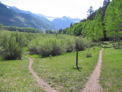
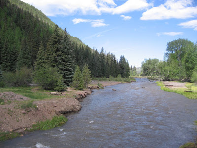
The Willow Divide Trail is a 30 mile loop ATV trail, and Forest Road 727, that climbs about 2000 feet to the high mesa area between the West Fork of the Dolores River and Fish Creek in the San Juan National Forest in southwest Colorado. This area is just to the southwest of the Lizard Head Wilderness Area.


I started at the south trail head along Forest Road 535. Traveling from the south this is about 25 miles north of the town of Dolores along paved roads. From Telluride, Road 535 intersects with Highway 145 a few miles south of Lizard Head Pass and is marked as the Dunton Road.
The trail is a 4WD drive road that climbs steadily with switchbacks. The lower part of the route has good views to the south down the West Fork valley and across the valley to Stoner Mesa. There are other trail heads nearby, the Goble Trail and Fish Creek Trails are just to the south and the north end of the Stoner Mesa Trail is across the valley on top of the mesa. Further up the views open up to the north toward the Rico Mountains. I was hoping to see the high peaks of the Lizard Head area but no luck. The lower trail forest has Ponderosa Pines and Aspens and Gambel Oak and a few Narrow Leaf Cottonwoods.

After 2:00 hours and about five miles I arrived at what I took to be the loop junction. I stayed to the right, still on Road 727, which seemed to continue to climb slightly.

The route to the left is narrower and seems to stay along a level contour. The forest here is dominated more by Engelmann Spruce and there are views to the west over Fish Creek to Black Mesa.

I continued on for another 40 minutes and there were a few glimpses of Dolores Peak and a distant glimpse of El Diente but the views were mostly obscured by the thick forest.
I think that the north end of this route has the second hut on the Durango to Moab hut to hut mountain bike route but I didn't go that far. The first hut is near Bolam Pass at the east end of the East Fork Trail. I turned around after 2:40 hours and returned for a total hike of 5:00 hours.


Thursday, August 7, 2008

Groundhog Stock Trail-East

This east five mile segment of the Groundhog Stock Trail starts at the Cross Mountain Trail Head, about two miles south of the Lizard Head Pass in the San Juan National Forest in southwest Colorado. There is also a western segment near the Navajo Lake and Burro Bridge Trails.

After about ten minutes on the Cross Mountain Trail, the Groundhog Stock Trail branches off to the left and travels to the southwest along the edge of the Lizard Head Wilderness Area. This area has three of the Colorado 14ers, plus the unique Lizard Head formation.


The first mile of the trail passes through thick spruce and fir forest. There were some mud holes and some spots where the trail is a little vague through this area.

 After about 45 minutes the trail arrives at a flower filled moist meadow, then exits the thick forest.


After the forest meadow the route opens up giving good views and descends steeply down to Slate Creek where there is a footbridge.

 Slate Creek flows down and becomes an early contributor to the Dolores River near the Cayton Campground. There is the second smaller Coke Oven Creek a little further on.

After Slate Creek the trail grade is reasonably flat through a long area of meadows with islands of spruce and fir. There are good mountain views both ahead and behind and lots of summer wildflowers in the meadows.

The last segment of trail passes along the north side of a very wide and long meadow area. There was a confusing spot where an old road section of trail appears to dead end when entering the meadow. The inconspicuous single track trail continues to the right around the shoulder, avoiding the mushy spots below.

The trail ends at the east end of The Meadows along Forest Road 535, and the south flanks of Mount Wilson come into view. I took about 4:30 hours to walk this 10 mile out and back route.


Friday, August 1, 2008

East Fork Trail-Lizard Head Pass

The East Fork Trail climbs up toward Bolam Pass along the East Fork of the Dolores River just to the east of the Lizard Head Wilderness in southwest Colorado. The trailhead is along Highway 145 about two miles south of Lizard Head Pass.


At the start of the hike there are good views to the west to the Lizard Head and Cross Mountain and to the south down the Dolores Valley.

The trail is well above the stream and passes through islands of mostly Engelmann Spruce and open meadows. The trail is used quite a bit by horse riders and some mountain bikers. It seems to part of the hut to hut Durango to Moab bike route.

I spent a few minutes telling a struggling rider what I knew about the route from the Bolam Hut west past Lizard Head to the next hut. The first four miles of the trail has a mild grade, with some mild rolling up and down.
About 2.5 miles along the route there are two creek crossings back to back, deep enough to get your feet wet. These are the North Twin Creek and the South Twin Creek, flowing down from the Sheep Mountain group of peaks that form the east side of the valley, but are hidden from view by the forest.

There aren't many long views along this trail. There are views down to the East Fork River below and across the meadows and many sections pass through the islands of tall spruce. The meadow areas along the trail are thick with wildflowers. After four miles the grade gets a little steeper.

I was looking for a marker that said Bolam Pass but didn't see one. At the end of my route I was on a rough road that had a small sign indicating it was part of the Colorado Trail.

I turned around after 3:20 hours at a point where I could see mountains both to the east and the west and the road seemed to be leading back down hill. Going back was a little quicker than going up and my total hike was 6:00 hours and about 12 miles.


Friday, July 4, 2008

Kilpacker Trail

Kilpacker Trail is an alternate route leading to Navajo Lake from the south side of the Lizard Head Wilderness, near Telluride in southwest Colorado.

The Navajo Lake Trail head is about 1.2 miles to the west. The two trails run parallel to the north for about three miles. The Kilpacker Trail provides access to the Kilpacker Creek Basin for those attempting to climb El Diente, at 14,159 feet, one of the Colorado 14ers. El Diente is a tooth shaped peak just to the north of Mt. Wilson, also a 14er.

I started my hike about 1.5 miles east of the trail head, to view the wide expanse of The Meadows. Continuing on the first section of the Kilpacker Trail gives a longer view of this spectacular area.

The trail is mostly through thick spruce and fir forest with occasional views of Dolores Peak to the west. The nearby Navajo Lake Trail travels more through open meadows and the mountains are more visible. After about one hour and about 2.3 miles, I arrived at Kilpacker Creek.

A little before the creek I noticed a sign and a trail to the right that said "El Diente Peak Route". This is the route that climbers take up the basin to get into position to climb the "Big Tooth".

The Kilpacker Creek had a small waterfall in the vicinity of the trail crossing. There wasn't an easy way to cross the creek without getting my feet wet.
I back tracked from the falls to the El Diente Peak Route and followed that route for 15 minutes uphill until it also reached the Kilpacker Creek.

There was a better glimpse of El Diente here. Looking at some climbers reports on El Diente later, I saw that there are two waterfalls further up the basin.

My hike on Kilpacker was about 1:00 hours to the Creek, another 0:30 to go up and back the climbers route, and another 1:00 back to the trail head for a total of 2:15. I spent an additional 1:00 hour walking along the Meadows road as part of the same hike.

18407_$5 Shipping on Orders of $99 or More!

Thursday, July 3, 2008

The Meadows at Lizard Head Wilderness

The Meadows is an area along Forest Road 535 in the San Juan National Forest just south of the Lizard Head Wilderness in southwest Colorado. The expanse of green sits below one of the famous Colorado 14ers, Mount Wilson at 14,246 feet. Another 14er, El Diente is just out of view behind Mt. Wilson.


I arrived from the south, driving up the West Fork of the Dolores Road and parked at the junction with Forest Road 471 which leads back to the south to the Calico and Winter trailheads. This area can also be accessed on the Dunton Road south of Lizard Head Pass from Highway 145. I hiked to the west toward the Kilpacker Trail, about 1.5 miles away.
 
Gazing to the west there is a glimpse of Dolores Peak, no slouch at 13,290 feet, and an oddly placed cabin site.


 Looking back to the east is the mountain group that overlooks Lizard Head Pass and the Trout Lake area. The Groundhog Stock Driveway Trail leads that way and connects to the Cross Mountain Trail, part of the Lizard Head Trail System.


The old cabin sits along Meadows Creek. The low areas of the meadows area are often a little mushy, but it appears possible to walk along the edges all the way around.
 
There is a dirt road turnoff leading to the Kilpacker Trail Head. Looking back to the east, there is a full length view of the meadows and the mountains to the east of Lizard Head Pass. I continued on the Kilpacker Trail, hiking around the area for 3:15 hours.


Friday, June 27, 2008

Ghost Town on Alta Lakes Trail

One of the several highlights of hiking the Alta Lakes Trail is the ghost town of Alta, about 0.6 miles from the lakes. Alta Lakes Road turns east off of Highway 145 between Telluride and Lizard Head Pass, just north of Ophir in southwest Colorado.

The site appears to be well protected, apparently on private property with fences deterring any poking around inside the old structures. They certainly had a good view from up here, around 11,000 feet up.

Water for the mining activity was probably managed using the Alta Lakes which appear to have been engineered using small earthen berms. The Alta town site was the center of mining activity in the Alta-Gold King area from 1877 to 1948. A fire in the mill ended the activity here. It is about four miles along the steep Alta Lakes Road to the town of Alta.
Alta was one of the first Industrial sites to use alternating current electricity. A long distance transmission line was completed from the Ames power plant on the San Miguel River on June 21, 1891.


The Ames power plant still operates using water from nearby Trout Lake. Some of the pipework is visible along the Galloping Goose Trail.

Thursday, June 26, 2008

Alta Lakes Trail

The Alta Lakes Trail follows gravel Alta Lakes Road east off of Highway 145 in southwest Colorado between Telluride and Lizard Head Pass and is about a 4.5 mile walk. This road is normally easily driveable and most visitors will be driving.

The road climbs steeply through thick Aspen and Spruce Forest. The walking is easy enough on the smooth road.
The lower part of the road provides spectacular views to the east and south to the San Miguel Mountains and the Lizard Head area, and it gets better the higher you go. As the road gets higher the mountains to the east become more visible.

Some of these peaks have the look of "needles" that a few other sites in the region have. Higher still and the famous "Lizard Head" comes into view back to the south.

After 1:45 and about 4 miles the ghost town of Alta appears. This site is fairly well preserved and was active from 1877 to 1948.  (use the labels to see separate post on the ghost town.)

From Alta, a hiker can continue on the road or take a short trail that starts at the back of the ghost town site. In the vicinity of the trailhead there is an alternate route coming up here from Telluride called Boomerang Road, and Lift 10.

There are three Alta Lakes and they have an engineered look to them, some constructed berms and flow control valves, but the setting is spectacular. 


It took me 2:00 hours to arrive at the Alta Lakes including a short stop at the Alta ghost town. I spent about 1:45 hours hiking around and between the lakes before returning. This appears to be a popular camping and fishing spot and is also a popular back roads 4WD destination.

532497_120 x 90 Starting Salary $42k. Group 1 528669_Russell Womens Fleece Hoodie Banner

Monday, June 23, 2008

Telluride Bike Trail

The Telluride Bike Trail runs along the north side of the Valley Floor west of Telluride in southwest Colorado, and connects to the Galloping Goose Trail and the River Trail near the junction with Highway 145.
Normally, a paved trail next to a highway wouldn't be a hikers choice, but the views in the Telluride Valley Floor are worth it and the Bike Trail completes a six mile loop with the River Trail on the south side of the canyon. The Bike Trail includes a tunnel under the spur route into Telluride town. Towards the west end of the trail the San Miguel River starts to come more into view.

The Valley Floor area was the subject of a development vs. conservation controversy that appears to have been settled in favor of conservation. I spotted a small group of elk along the trail that were taking a dip in the wetlands.
There is a bridge at west end that gives a good view up the canyon and over the river. My hike started here at the west end near Highway 145 and followed the 3 mile River Trail into town, then on to the free Gondola to Saint Sophia Station with the 2 mile hike down into Mountain Village on the Ridge Trail.
I returned to Telluride on the Gondola and hiked the 3 mile Bike Trail back to my starting point. This trip of about 8 miles took me about 4:45 hours.

Sunday, June 22, 2008

Telluride Ridge Trail to Mountain Village


The Telluride Ridge Trail is a 2 mile route between the St. Sophia Station of the Telluride Gondola and Mountain Village, the part of the Telluride Ski Area that doesn't fit into the main valley.


I started at the St. Sophia Station after riding the free Gondola up from Telluride Town. The Gondola station in town is right off the River Trail, offering some connectivity for an ongoing hike.
The Ridge Trail starts just under and to the right of the Gondola. At the same point there are ski roads leading back down to Telluride. There is a Nature Center at St. Sophia that has information on other trails on the mountain, and some activities for children.

The upper part of the trail is steep and rocky but offers some stunning views. Everyone I talked to said to watch out for mountain bikers rambling down hill.

The forest is very thick along the Ridge Trail with spruce, fir, and aspens. The trees are so thick that the mountain views are reduced to glimpses in some spots. The trail gets smoother and less steep lower down. The trail ends very near to the Mountain Village Gondola Station.

Mountain Village has what appears to be more of a European village architecture style, rather than the Victorian style that prevails in Telluride. The golf course is up here, saving the Valley Floor for open space. I rode the Gondola back up and then back down into Telluride Town.

Saturday, June 21, 2008

Telluride Valley Floor River Trail

The Valley Floor River Trail visits an area near Telluride in southwest Colorado that has been the subject of an intense legal battle in recent years between development and conservation.


I started my hike at the point where Colorado Highway 145 from the south makes a left turn to the west with the three mile spur into Telluride box canyon going to the east. This point is also a starting point for the Galloping Goose Trail and the Telluride Bike Trail.
 
The trail hugs the south side of the valley up against a steep slope thick with spruce, fir and aspen trees. Several small streams spill down to join the San Miguel, one of the few streams in Colorado without a dam on it. The story I gathered from internet sources is that in December of 1999, San Miguel Valley Corporation (SMVC) revealed updated plans for development on the Valley Floor.
These plans included a large hotel complex, a gondola link to the ski town Mountain Village which is just over the south ridge, an 18-hole golf course, commercial areas, condominiums, and single homes.  
On July 3, 2000, a public demonstration drew approximately 1,500 people to the County Courthouse steps for a Rally for the Valley, with participants roaring, “Free the Valley.” As reported by The Denver Post, “Dreadlocks cozied up to designer pants suits, movie stars linked up with ranch hands, tie-dyes connected to Ph.D.s, second-home owners gripped tent dwellers, tots hung on to retired miners. It must have been quite a scene.
Walking around town you see the odd mix drawn to this very scenic and trendy town, and I'm always impressed by the very nice looking dogs.

Some of the peaks of the Sneffels Wilderness Area are visible are visible as you stop and gaze along the river banks. There is the Telluride Bike Trail on the north side of the Valley that gives a view back toward the more heavily forested south side. The Bike Trail can be used to make a loop trip for both hikers and bikers.


On June 25, 2002, Telluride residents voted 609- 385 in a special election to pursue eminent domain for attainment of 570 acres on the south side of the Valley Floor to be placed under a conservation easement in perpetuity. The dispute was whether the town had the legal right to do this. After four months of deliberation, the Colorado Supreme Court ruled 6 – 1 in favor of the Town of Telluride in its long-standing effort to acquire the 570-acre gateway meadow known as the Valley Floor.

About one mile west of Telluride, the Boomerang Road descends from the area near the golf course and makes a junction with the Valley Floor River Trail.


This is a steep old road passing through the Spruce-Fir Forest. At the top of the Boomerang Road, there are some good views toward the mountains that are directly across. I took about 1:15 to complete the three mile walk. Once in the town of Telluride you will probably want to continue on the in town part of the River Trail.


In the in town part of the River Trail here has been an ongoing project for restoring the natural habitats of the San Miguel River below that have been damaged over the years by mining and resort development. Improved aquatic habitat in the river channel by creating a variety of natural appearing features including riffles-pools-glides and in stream cover.