The Dillon Pinnacles Trail is a 4 mile round trip along the north side of Blue Mesa Reservoir in the Curecanti National Recreation Area, east of Montrose, along Highway 50, in southwest Colorado. The Curecanti area is upstream of the Black Canyon of the Gunnison National Park.

There is a pullover view area when approaching the Dillon Pinnacles from the west along Highway 50. Interpretive signs at the view area say that the Dillon Pinnacles began 30-35 million years ago during a period of volcanic activity that built up the nearby West Elk Mountains and the San Juan Mountains.
The lava, mud flows and rocks from the volcanoes built up the breccia that forms the pinnacles. Only 2 million years ago the Gunnison River cut through the area to form the Black Canyon of the Gunnison. Now, this segment of river below the pinnacles is the Blue Mesa Reservoir.

Just east of the view point there is a bridge and the trailhead is just across the bridge. The first segment of the trail approaches from the east and passes through a sagebrush area. At first, this seems like it is going to be a desert hike.

The middle segment turns north along a seemingly dry drainage, but which has riparian habitat and even Ponderosa Pines start to appear. Although they are not obvious in the first part of the trail, there are pines and firs on the on mesa top and some of them creep down the hillsides in the drainages.

The last segment turns west and heads for a flat hilltop viewpoint below the west end of the pinnacles. Interpretive signs along the trail say that the West Elk Breccia is 600 feet thick. It is formed of hardened molten rocks cemented together in a matrix of ash.
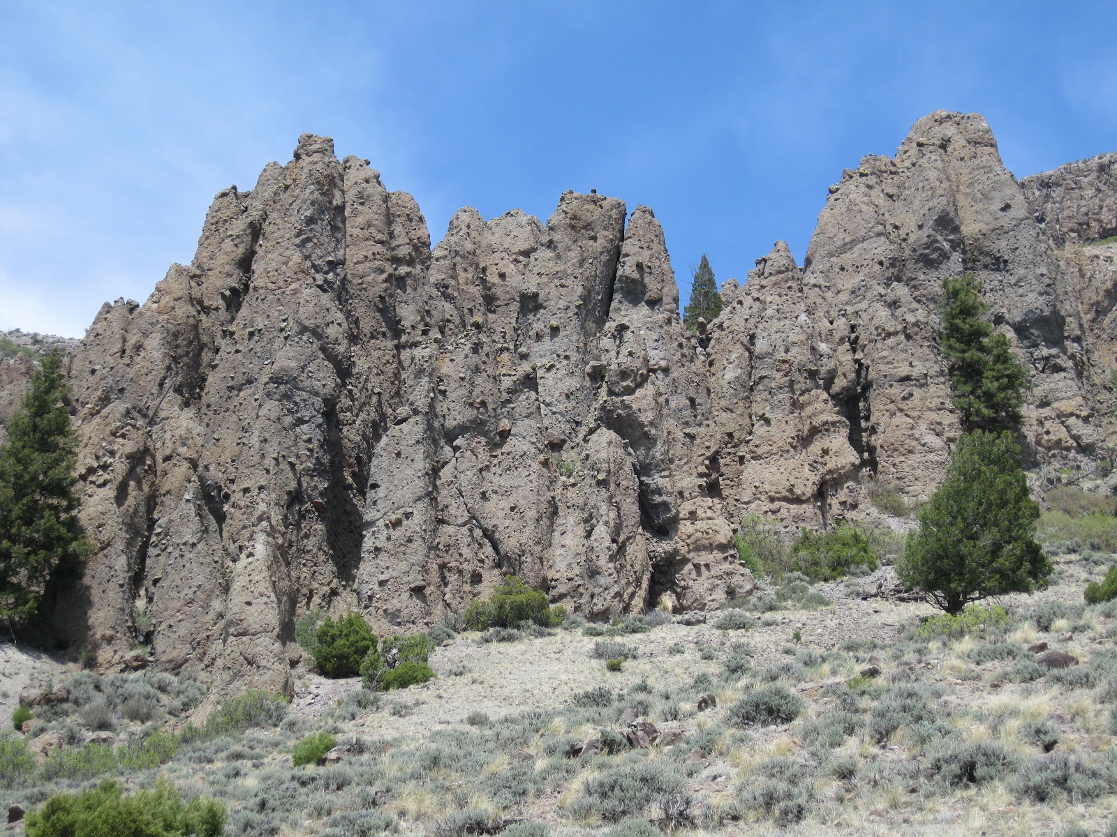
Later eruptions in the San Juan Mountains formed a cap rock or welded tuff on top of the breccia. The resistant cap rock causes the formation of the pinnacles.

Near the end of the trail there is a small scale pinnacle. An interpretive sign here says that the angular rocks are Andesite. The binding material is ash, pumice and dust.

There are several good benches along the trail at shady spots or good view points. The last part of the trail is a short loop that finishes on the flat hilltop below the pinnacles, with good views over the Blue Mesa Reservoir. It took me 1:00 hour to arrive at the end of the trail and 0:50 minutes to return for a total hike of 1:50 hours. I hiked on an 80 F degree, breezy late May day and carried 2 liters of water.


No comments:
Post a Comment